Optional capabilities

Defense & Map Coordination

GeoInsights is a self-hosted geospatial analytics platform for cities, utilities, and enterprise operations, not a military-first product. Teams that need map coordination tools can use the capabilities below on the same Operations Map.

GeoInsights does not include TAK (Team Awareness Kit) integration. There is no TAK Server or WebTAK sync in this product.

Range Rings & GRG

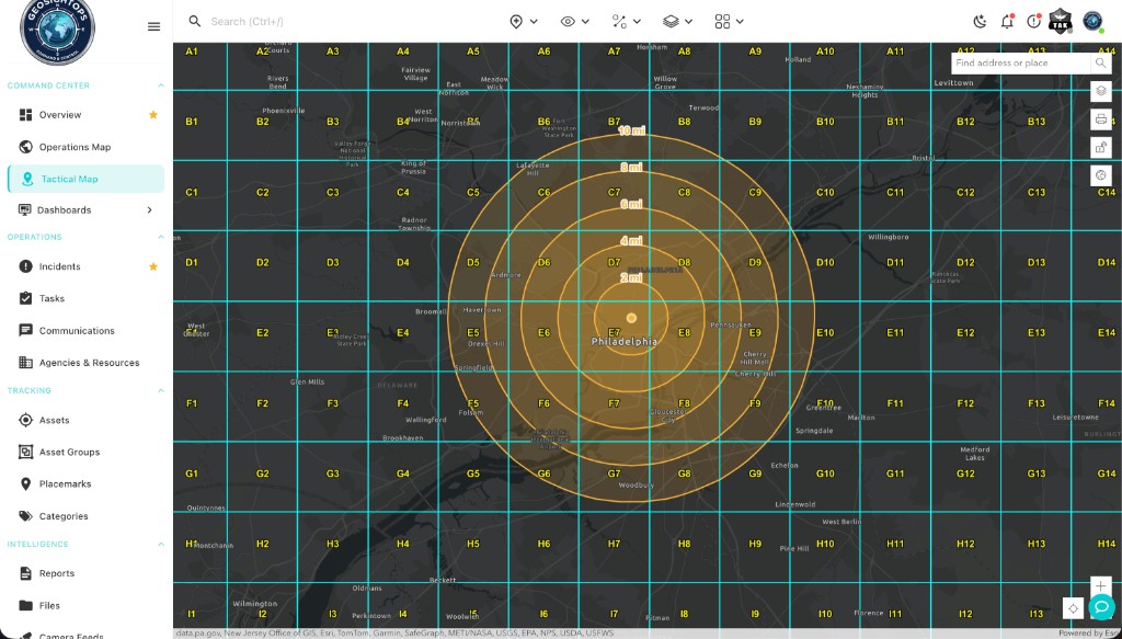
Concentric distance rings from any anchor point, plus georeferenced Gridded Reference Graphics so every operator shares the same grid cells on the Operations Map.

GRG grid with range rings on the Operations Map

Full walkthrough & gallery

When teams need higher-stakes deployments

Optional use cases for defense, public safety, and secured environments, on your infrastructure, under your control.

Theater-grade situational awareness

Defense & public safety. Self-hosted deployment for asset tracking, secured facilities, and multi-agency coordination. Air-gapped and on-premise options for compliance-driven environments.

Air-gap ready Full data sovereignty Multi-source fusion

Shared map graphics

Range rings & GRG. Drop distance rings (mi / NM / km) and labeled grid overlays so field and ops teams reference the same cells, with MIL-STD-2525B and NAPSG symbology on the map.

Range rings GRG overlays Standard symbols

Protect critical infrastructure

Facilities & perimeters. Combine sensor feeds, camera fusion, and geofence alerts with the same pollers and dashboards used for civic and enterprise GIS workflows.

Perimeter alerts MQTT & HTTP pollers SCADA-ready patterns

Explore the core platform, data pollers, layers, alerts, and dashboards on the homepage.

Back to GeoInsights home Contact Us